Borrowed Shore
Borrowed Shore
Borrowed Shore
Borrowed Shore
Borrowed Shore
Borrowed Shore
Borrowed Shore

Borrowed Shore
Borrowed Shore
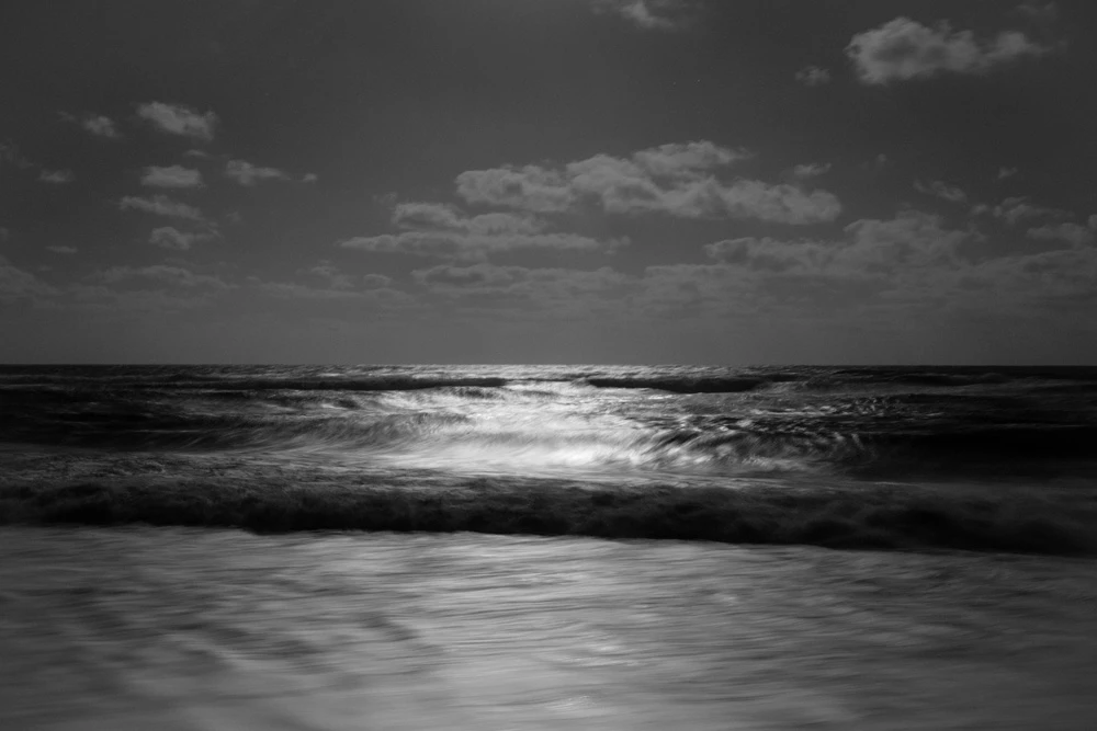
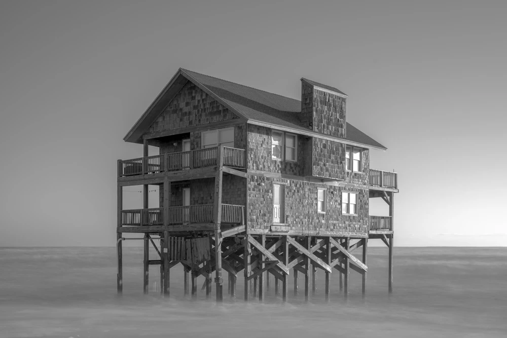
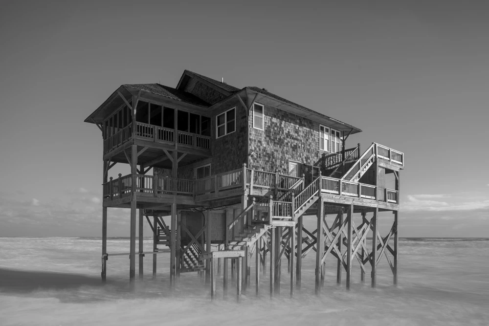
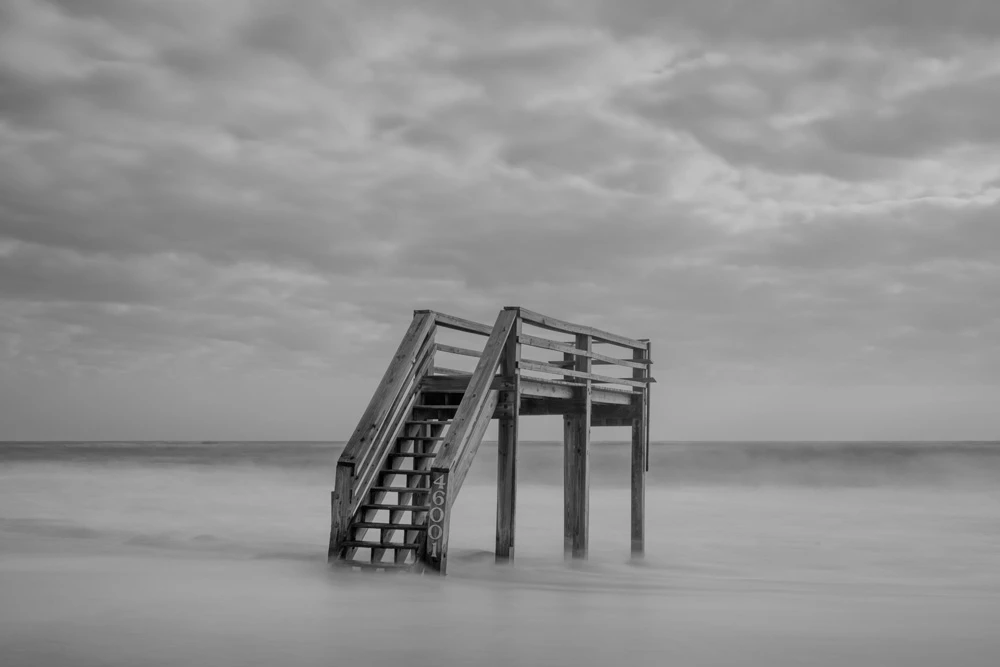
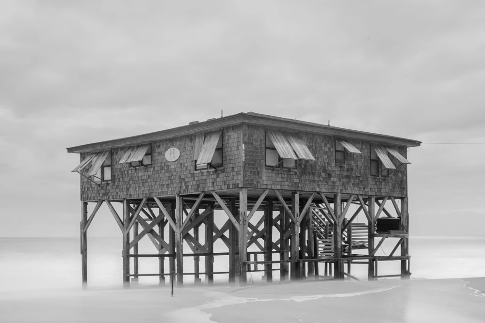
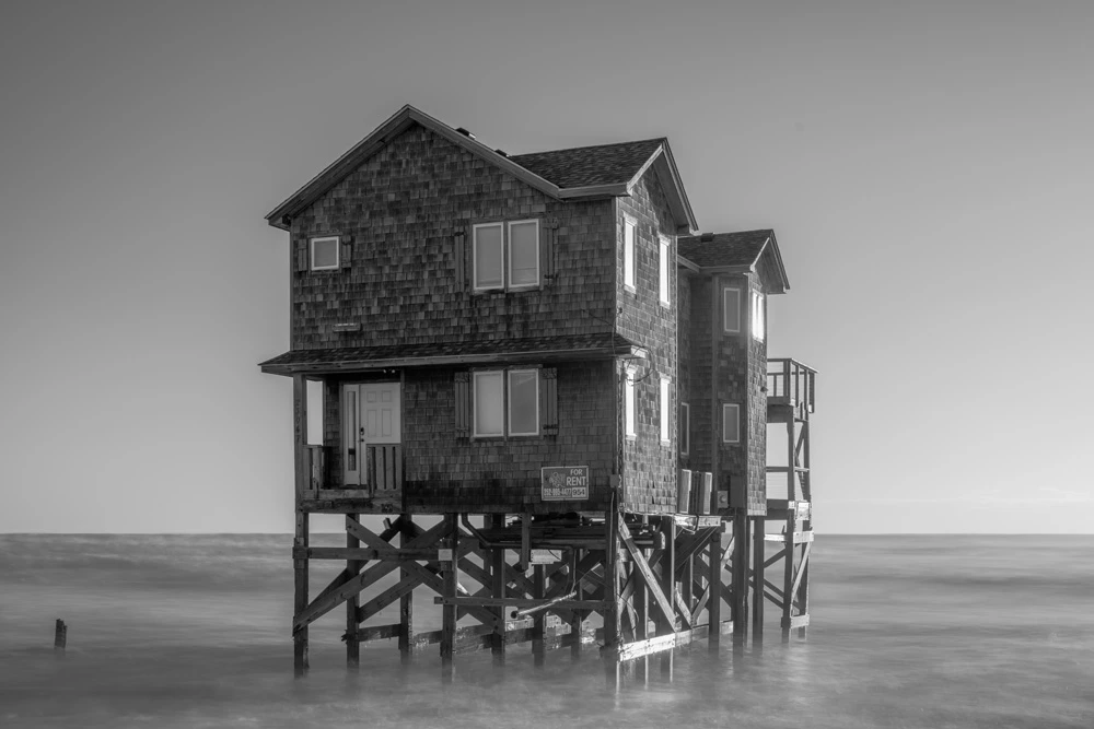
Along the Outer Banks of North Carolina, houses are collapsing into the ocean. Shoreline erosion has always reshaped this coast, but in the context of human-caused global warming, the process has accelerated. Rising seas and stronger storms have brought a sense of urgency. These homes stand as symbols of human hubris and fragility — they are testaments of our attempt to hold ground against powerful forces larger than ourselves.
Sea level rise is not new. After the last ice age, between 21,000 and 11,700 years ago, global temperatures rose about 7.2°F, and the oceans rose roughly 279 feet. Even after warming leveled off, the ice sheets continued to melt for another 8,000 years, adding another 148 feet. For nearly three millennia, sea levels remained relatively stable. However, the past century tells a different story: global temperatures rose by about 1.8°F and sea levels climbed 6 to 8 inches, with half the rise occurring since 1993. This current rate is unprecedented in the last several thousand years. N.A.S.A. satellites, tide gauges, and ocean sensors track these changes in real time, showing how ice loss and warming oceans contribute to an accelerating crisis.
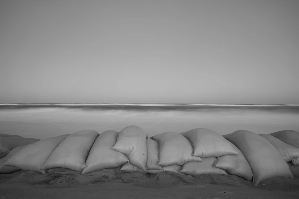
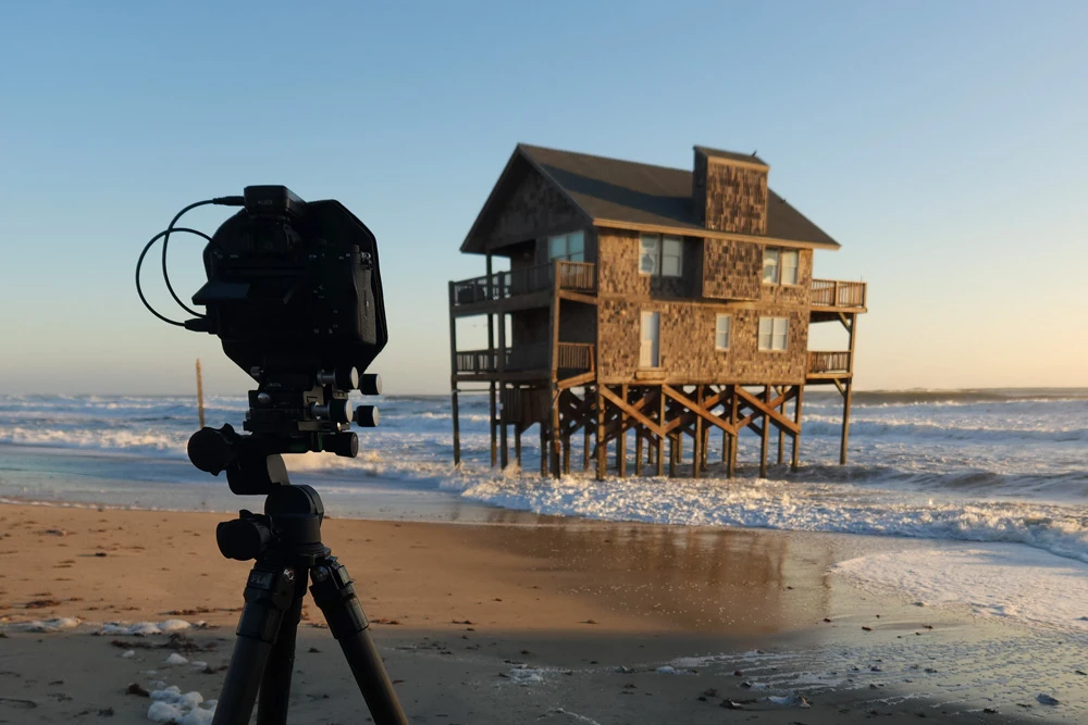
This project is rooted in both photography and material. I am increasingly interested in the photographic print as an object, something that holds deeper meaning, beyond mere aesthetics. To connect this work to the very subject it represents, I print the images using a pigment made from black sand collected from nearby beaches. This sand was brought here as a form of “beach nourishment,” an attempt to slow erosion by dredging heavy sand from offshore and depositing it on the beach. While the language of nourishment suggests generosity, the reality is more complicated: studies reveal that saving one stretch of shoreline can accelerate loss in another. What protects one community may come at the expense of another.
22909 North Carolina Hwy 12
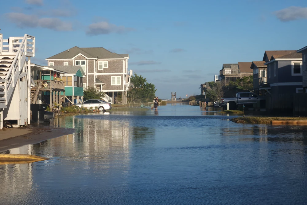
Tidal flooding in Buxton
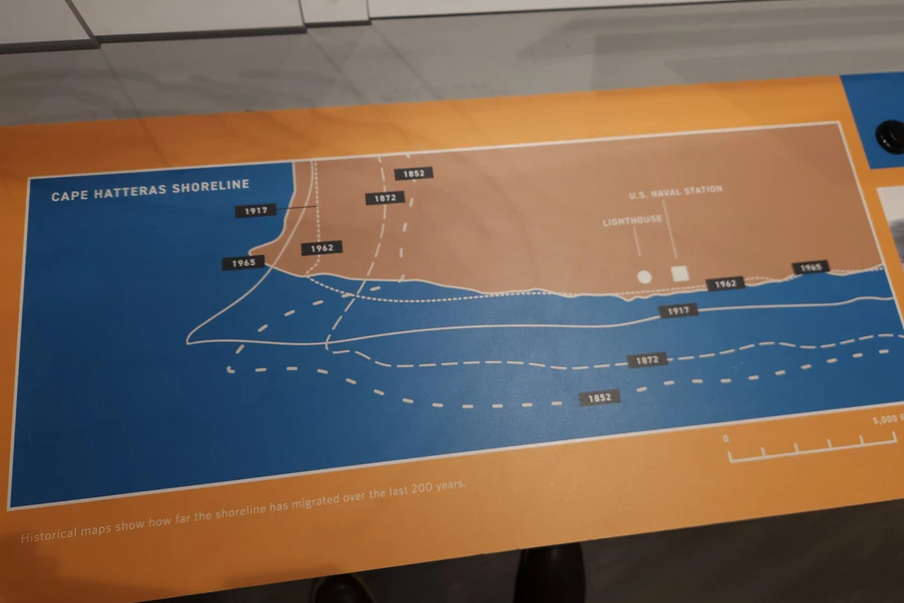
Historical maps show how far the shoreline has migrated over the last 200 years
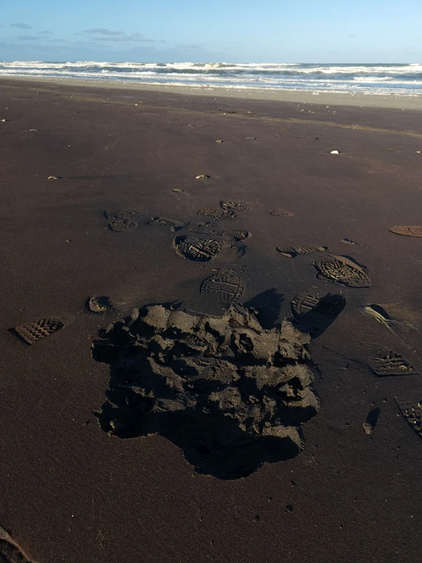
Black sand on Pea Island Beach